
Free 3D Editor Download
TNTatlas
About this software:
Free geodata viewer that lets you publish and distribute your maps and geospatial data from a single geodata file to complex map layouts prepared using TNTmips.
TNTatlas puts you into the publishing and distribution business. Your geospatial data can be collected, organized, and distributed to any target audience.
TNTatlas lets you display massive sized geodata and will directly display numerous file formats including shapefiles, GeoTIFF, JP2, PNG, MrSID, DXF, and DWG.
Version 2022.20221130 is a freeware program which does not have restrictions and it's free so it doesn't cost anything.
 Zoom: TNTatlas
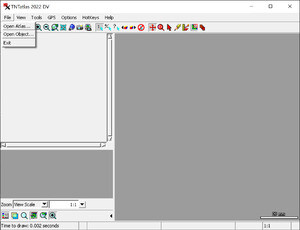
TNTatlas puts you into the publishing and distribution business. Your geospatial data can be collected, organized, and distributed to any target audience.
TNTatlas lets you display massive sized geodata and will directly display numerous file formats including shapefiles, GeoTIFF, JP2, PNG, MrSID, DXF, and DWG.
Version 2022.20221130 is a freeware program which does not have restrictions and it's free so it doesn't cost anything.
Virus and Malware Tests:
The program has been tested with several antivirus applications and has tested clean of viruses, malware or trojans.Download TNTatlas
58.9 MB - Filesize
Details
| Publisher: | MicroImages, Inc |
| License: | Freeware |
| OS/Platform: | Windows 7, Windows 8 (64-bit, 32-bit) / Vista / XP |
| Filesize: | 58.9 MB |
| Filename: | TNTatlas_2022_Win_2022120... |
| Cost (Full Version): | Free |
| Rating: |
3 out of 5 based on 1 rating.
|
| TrustRank | Based on many factors, we give this program a Trust rating of 5 / 10. |
 |
|